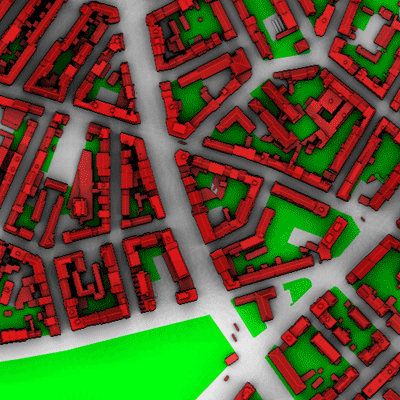
The site "Basel-Spalenring" is located in the western part of the city of Basel in an area with a
slightly different building structure and especially more trees than Basel-Sperrstrasse. Here, measurements at the tower on the roof
of the former Institute of Meteorology (University
of Basel) exist since 1994. In
the frame of BUBBLE the instrumentation has been enhanced by a profile of
six ultrasonic anemometers, a wind profiler by MeteoSwiss
and a LIDAR operated by the Observatory of Neuchatel.
Panorama from the
tower at 33m. (download
jpeg-image including labels) 23.08.2002
Click with mouse down
in the image to move around.
Landuse and building geometry from a digital building model is available for a 1 km radius around the site.
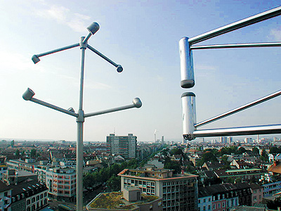
The Photo shows the urban surface in Northern direction photographed from the tower with one of the six ultrasonic anemometers coupled with a
fast hygrometer.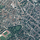 |
Aerial Photo of the station sourrounding approximately 1 x 1 km (Password protected). The cross on the aerial photo refers to the location where the turbulence tower was installed and the backyard where the wind profiler and the LIDAR were operated. |
|
|||||||||||||||||||||||||||||||||
|
|||||||||||||||||||||||||||||||||
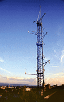 |
The tower "Basel-Spalenring" had a total height of 38m from street level, the tower itself was 23m (23.9.2001, 24.9.2001) | ||||||||||||||||||||||||||||||||
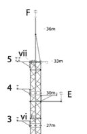 |
Detailed plan
of the tower in pdf-format.
|
||||||||||||||||||||||||||||||||

|
The ultrasonic anemometer profile
consisted of six METEK USA-1 that were operated from tower top (38m) down into the
street canyon westward of the tower. There are alley trees inside the canyon (24.9.2001).
Click on the Image to view a labeled photograph with the measurement locations |
||||||||||||||||||||||||||||||||

|
The ultrasonic anemometer profile in a labeled photograph composition illustrating both street canyon and tower. small large | ||||||||||||||||||||||||||||||||
 |
The eddy-correlation system for latent heat flux measurements with a Campbell Scientific Krypton KH20 hygrometer in 29m | ||||||||||||||||||||||||||||||||

|
The two upper ultrasonic anemometers inside the street canyon (24.9.2001) | ||||||||||||||||||||||||||||||||
 |
The radiation instrumentation on top of the tower included two WRC/Eppley PIR Pyrgeometres and two Kipp & Zonen CM21 / CM11, one in each sphere. (28.6.2001). | ||||||||||||||||||||||||||||||||
 |
The upward-looking Eppley PIR (28.6.2001) | ||||||||||||||||||||||||||||||||
 |
The radiation instruments during a winter morning situation with dew on the domes. (23.1.2001). | ||||||||||||||||||||||||||||||||
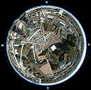 |
Fisheye
view of the downward-looking radiation instruments Photo provided by Geoff Doerksen, UBC |
||||||||||||||||||||||||||||||||
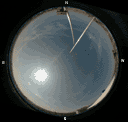 |
Fisheye
view of the upward-looking radiation instruments, with the fixing for
the top sonic inside the field of view. Photo provided by Geoff Doerksen, UBC |
||||||||||||||||||||||||||||||||
 |
Dewpoint sensor of the type "Meteolabor Thygan" (28.6.2001) | ||||||||||||||||||||||||||||||||
 |
A total of 7 psychrometers are installed at Basel Spalenring, inside the street canyon, in the backyard and at the tower. Here, the one in 33m is shown (28.6.2001). | ||||||||||||||||||||||||||||||||
 |
This
picture shows the wind-profiler of
MeteoSwiss in the backyard (28.6.2001).
|
||||||||||||||||||||||||||||||||
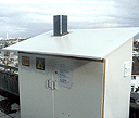 |
The
LIDAR operated by the Observatory of Neuchatel on the roof of the
Institute building at Basel-Spalenring (6.12.2001).
> LIDAR Documentation (PDF) |
||||||||||||||||||||||||||||||||
