 |
Basel
- Lange Erlen
The
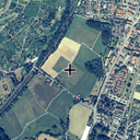
energy balance station "Basel - Lange
Erlen" is located in the valley of the River "Wiese" in
the
Northeast of the city of Basel. The
station is similar to Gempen and is operated
coninuously sincs 1991 by the University
of Basel. It consists of a 10m micrometeorological profile tower with 4 levels, radiation
measurements, soil measurements and standard meteorological
instrumentation.

|
 |
| Name |
Basel
- Lange Erlen |
| Number |
Re3 |
| Site-Code |
BLER |
| Location
easting |
615835
m |
| Location
northing |
271310
m |
| Height
a.s.l. |
275
m |
| Height
of tower |
10
m |
| Vegetation |
Grassland |
| Shortwave
Albedo |
21.6%
(1) |
| Operation
period |
1991
- * |
| (1)
Mean value measured 2m above surface (March
15 to July 15 2002). |
|
 |
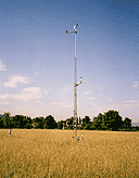
The
energy balance station at "Basel-Lange Erlen" with
radiation, soil, precipitation and wind measurement instrumentation.
The operational station of the University of Basel is operated since
1991. |
 |
The
net radiometer (Kipp&Zonen CNR1) measures all components over grassland. 02.05.2000 |
|
 |


