What is the Kärkevagge ?
What is the Kärkevagge ?
|
|
 |
Map of Swedish Lapland
The Kärkevagge belongs to the municipality of Kiruna, Swedish Lapland. Following the road from Kiruna in North-West direction, you come to Abisko, and after a couple of kilometres you will find the Kärkevagge.
The Kärkevagge ("vagge" comes from the Samen language and means valley) is about 5 km long and orientated from south-southeast to north-northwest. The Mt. Vassitjåkka (1580 m a.s.l.) in the West and the ridge of Kärketjårro (1400 m a.s.l.) in the East mark the border of the Kärkevagge. The bottom of the valley rises from 650 m a.s.l. in the North to 800 m a.s.l. in the South and ends at a cirque lake called Lake Rissajaure.
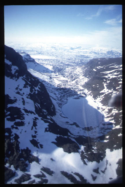 View from the South into the Kärkevagge with Lake Rissajaure. Click on the thumbnail to
enlarge (50kB).
View from the South into the Kärkevagge with Lake Rissajaure. Click on the thumbnail to
enlarge (50kB).
The investigation were carried out in the Kärkevagge since detailed information about the occurrence of slush stream is available, but also due to logistical advantages. Additionally, there is a very good cooperation with the Abisko Scientific Research Station since longer times.
· Top of page · MOSAIC home ·  KV home