digital elevation models


For high resoluted raster and vector buidling models see the 3d building model page
 
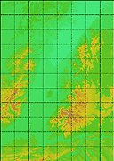
KABA-Elevation Model
of the Basel Region including parts of the 
Jura mountains to the South

Coordinate System: CH1903
SW: 591000 m / 242000 m, NE: 642000 m / 275000 m
Height in m a.s.l.

Download DEM 100m Resolution
(netCDF 2.4, 0.7MB, you need a password)

Download DEM 25m Resolution
(netCDF 2.4, 10.7MB, you need a password)

ncdf file contains 3 variables:
> Digital Elevation Model [m]
> X-Axis (Easting)
> Y-Axis (Northing)


REKLIP-Elevation Model
of the whole Upper Rhine Valley from Strassbourg 
to Basel

Coordinate System: UTM 32N
SW: 335986.0 / 5240160.5, NE: 485506.0 / 5450014.5
Height in m a.s.l., vertical resolution: 10m

Download DEM 120m Resolution
(netCDF 2.4, 2.3MB, you need a password)

ncdf file contains 3 variables:
> Digital Elevation Model [short, m]
> X-Axis (Easting)
> Y-Axis (Northing)


< Data Center