In-situ observations
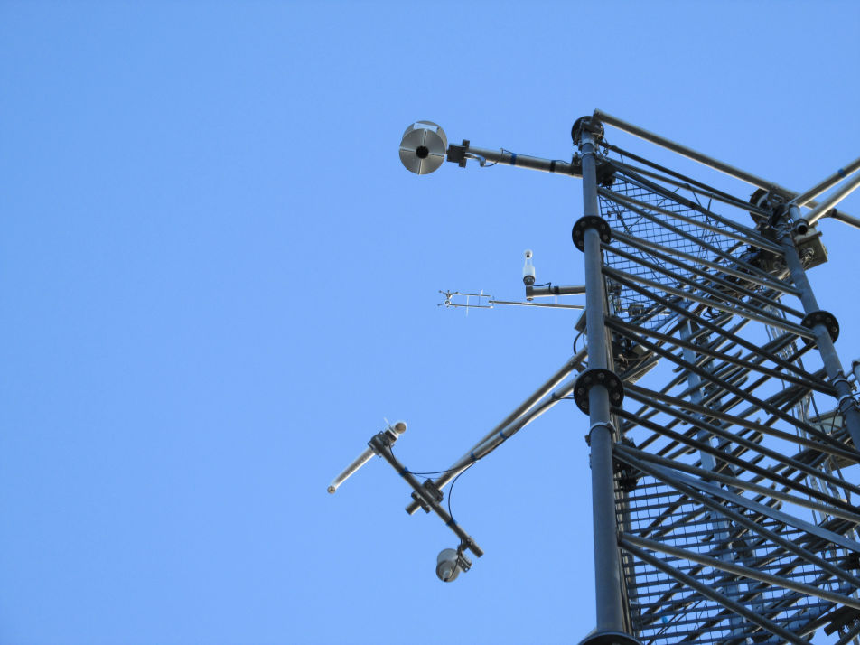
A set of 20 meteorological stations and 3 Eddy Covariance sites are currently active across Basel urban and peri-urban area.
Eddy Covariance
An overview of the Eddy Covariance fluxes can be found HERE
DATA ACCESS
A set of 20 meteorological stations and 3 Eddy Covariance sites are currently active across Basel urban and peri-urban area.
An overview of the Eddy Covariance fluxes can be found HERE
DATA ACCESS
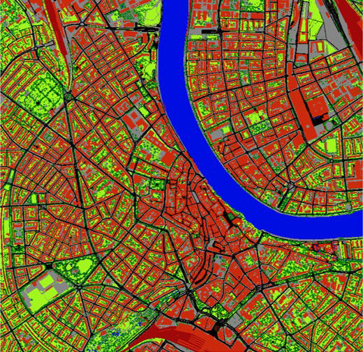
Land Cover map (V0.1) of Basel for diFUME project at three different levels of information. Level 1 information originates from the Official survey of Basel-Stadt (http://www.gva.bs.ch). Level 2 aggregates the information of Level 1 into 8 broad categories. Level 3 includes the information of tree canopies and crown, derived by airborne Lidar data (2012 campaign) made available by the civil engineering office of Basel-Stadt (https://www.tiefbauamt.bs.ch/).
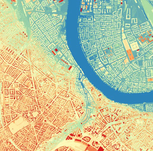
Digital Surface Model (V0.1) of Basel for diFUME project. The product describes the height in meters above sea level. It is produced by merging information by three different sources. Terrain model is calculated from the height model of the Basel-Stadt official survey and the building heights are derived from the 3D city model (http://www.gva.bs.ch). Information of tree crown height is derived by the airborne Lidar data (2012 campaign) made available by the civil engineering office of Basel-Stadt (https://www.tiefbauamt.bs.ch/).

Urban morphological and roughness indicators for Basel at 100 m resolution. The mean (zH), maximum (zHmax) and standard deviation (zHstd) of building height, the plan area index (pai - corresponding to the fraction of roof area), the frontal area index (fai - defining the area of building walls relative to total ground area), the roughness length (zo) and the zero-plane displacement height (zd) are calculated isotropically (i.e. all directions are integrated into one value for each parameter) for the study area using UMEP Morphometric Calculator.
This project has received funding from the European Union’s Horizon 2020 research and innovation programme under the
Marie Sklodowska-Curie grant agreement No 836443

Easiest Website Builder
FOLLOW US!